Openings · last 7 days
0
Pick a unit on the map to see its site map.
The site details and map below come from the public Recreation.gov record and are accurate. For current dates and to book, go to Recreation.gov.
Only 2 openings in the last 90 days: not enough recent activity for a reliable pattern. A free Campsite Sniper alert watches around the clock instead, and pings you the moment one opens.
The U.S. Army Corps of Engineers welcomes you to Barre Falls Dam, located in Massachusetts within the towns of Hubbardston, Barre, Oakham, and Rutland. Nestled within the 22,000 acre Ware River Watershed, the area offers many recreational opportunities. Such activities could include canoeing, picnicking, hunting, fishing, hiking, sightseeing, horseback riding, cross-country skiing, disc golfing, geocaching and wildlife observation.
The area offers many recreational opportunities including canoeing, picnicking, hunting, fishing, hiking, sightseeing, horseback riding, cross-country skiing, disc golfing, geocaching and wildlife observation. The Mid-State Hiking Trail crosses the Ware River Watershed and Barre Falls Dam. Other short trails are open for hiking, biking, bird watching, trail running, and more.
During the mid-1930’s and early 1940’s, the Metropolitan District Water Supply Commission converted most of the open farm lands into red and white pine tree stands. Natural re-vegetation occurred on areas not replanted, creating a mixture of hardwood and pine forests. Forest management by the Corps includes thinning, pruning, harvesting timber, replanting, and natural re-vegetation. These practices improve timber quality, produce forest products, create food and shelter for wildlife habitat, and enhance the recreational use of the resources.
Visitors to the 557 acres of federal public land at Barre Falls will find wetlands, forest, open fields, and river areas. These habitats are home to many species including songbirds, seasonal migrant birds, moose, waterfowl, whitetail deer, wild turkey, and rabbits.
Rutland and Moore State Park are located within 15 miles of Barre Falls Dam and offer a variety of recreational activities that include, hiking, fishing, canoeing, cross country skiing, picnicking and swimming.
From Boston: 1. Take I-93 N to MA-16 W/Mystic Valley Pkwy in Medford. Take exit 31 from I-93 N 8 min (4.5 mi) 2. Continue to Acton 29 min (20.1 mi) 3. F0llow MA-2 W to MA-140 S/MA-2A W in Westminster. Take exit 25 from MA-2 W 26 min (26.6 mi) 4. Take South St, New Westminster Rd and Barre Rd to Coldbrook Rd in Barre Springfield: 1. Take Pynchon St to E Columbus Ave 2. Take I-291 E, I-90 E, MA-32 N, South St and MA-62 E to Barre Rd/Coldbrook Rd in Hubbardston 1 hr 6 min (46.7 mi) 3. Turn right onto Barre Rd/Coldbrook Rd 4. Continue to follow Coldbrook Rd 5. Destination will be on the right 3 min (1.0 mi) Pittsfield: 1. Get on I-90 E in Lee from US-20 E 23 min (12.8 mi) 2. Follow I-90 E to Palmer. Take exit 63 from I-90 E 47 min (51.9 mi) 3. Continue on MA-32 N. Take MA-62 E to Coldbrook Rd in Barre
View on Recreation.gov ↗ Get directions ↗
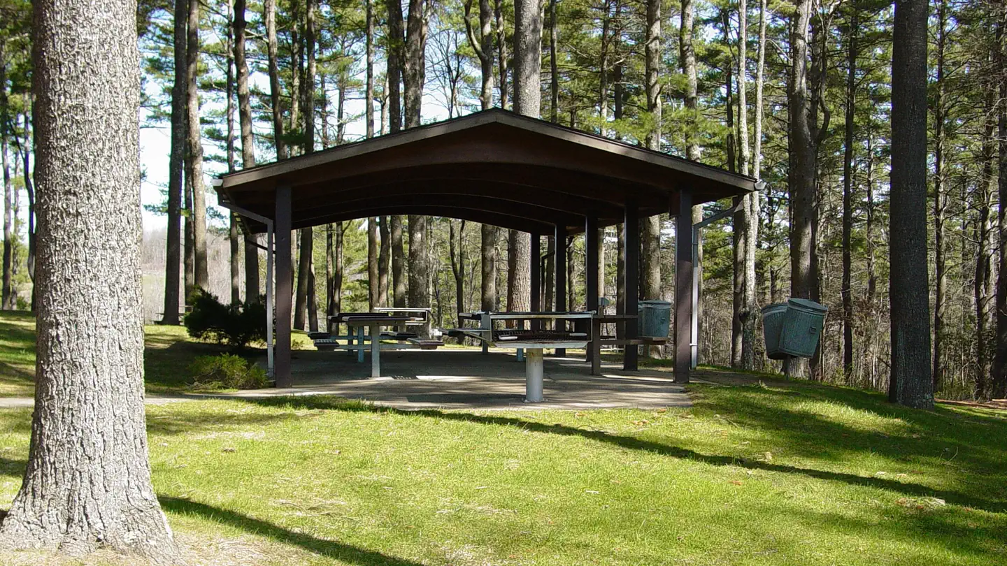
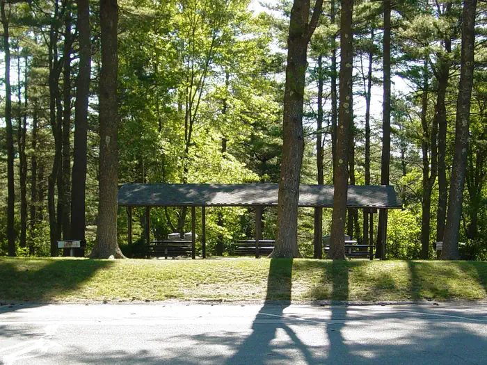
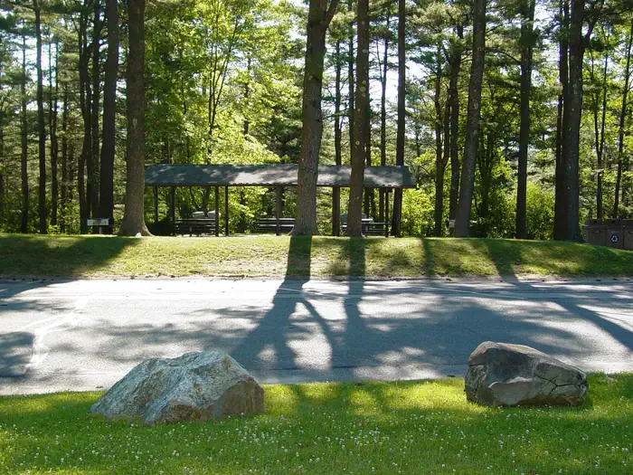
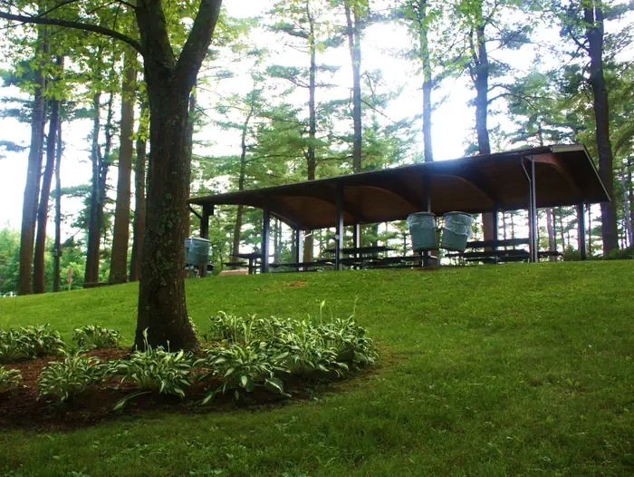
Online reservations for this facility, where offered, are made through Recreation.gov. Campsite Sniper has also detected 2 site openings here in the last 90 days, so further dates may appear. Pick the shelter on the map to see its reservation calendar, or set a free Campsite Sniper alert. You complete the reservation yourself on Recreation.gov.
No. Campsite Sniper sends alerts and direct Recreation.gov links. It never books, pays for, holds, hoards, or resells reservations.
Campsite Sniper does not currently hold availability data for Barre Falls Dam Picnic Shelter, so there is nothing to date here. That is a gap in coverage — it does not mean the facility is full or closed. Check Recreation.gov for current dates.
Campsite Sniper detected 2 site-date openings here over the last 90 days, none in the last 7. A free alert watches around the clock and pings you the moment one appears.
Choose the reservation dates you want at Barre Falls Dam Picnic Shelter.
Campsite Sniper can monitor this facility and notify you if a selected date becomes available.
When a selected date becomes available, you get a push with a Recreation.gov link so you can review and book it yourself.