No detected openings were recorded in the last 90 days. Campsite Sniper monitors Pocket Picnic Shelter continuously and will alert you if that changes.
Of the 183 tracked reservation dates (Sep 18, 2026 – Mar 19, 2027): 179 open for online reservation · 1 reserved · 3 on sites not offered for online reservation (first-come, first-served or administrative).
Where the open windows are
Load status
Sep 18, 2026 – Mar 19, 2027Of the open reservation dates on mapped day-use units, 104 fall on weekdays and 75 on weekends (Fri–Sun).
Open dates by month
Sep 2026 – Mar 2027December holds the most room. 31 of 31 reservation dates are still open there.
Holiday windows — day use
Units open per date · of 1 shelter| Window | Date | Units open | Status |
|---|---|---|---|
| Labor Day | SAT Sep 5 | 0 | None open |
| SUN Sep 6 | 0 | None open | |
| MON Sep 7 | 0 | None open | |
| Thanksgiving | THU Nov 26 | 1 | Open |
| FRI Nov 27 | 1 | Open | |
| SAT Nov 28 | 1 | Open | |
| Christmas | THU Dec 24 | 1 | Open |
| FRI Dec 25 | 1 | Open | |
| New Year | THU Dec 31 | 1 | Open |
| FRI Jan 1 | 1 | Open |
Labor Day: no online availability on any tracked date. Thanksgiving: 1 shelter is available for all three dates. Christmas: 1 shelter is available for both dates. New Year: 1 shelter is available for both dates.
Availability by shelter
Most open reservation dates · tracked window| Shelter | Open reservation dates |
|---|---|
| G01 | 179 |
This shelter currently has 179 reservation dates available.
Next windows
As of Sep 18, 2026 snapshotThe next bookable date is Sep 21; the first open weekend starts Sep 25. Campsite Sniper can watch later dates for you.
Reservation dates
All 1 shelter with current availability
| Shelter | Open reservation dates | Consecutive dates | Dates |
|---|---|---|---|
| G01 | 179 | 153 dates | Sep 21, Sep 22, Sep 23, Sep 24, Sep 25, Sep 26, Sep 27, Sep 28, Sep 29, Sep 30, Oct 1, Oct 2 +167 more |
About Pocket Picnic Shelter
Overview
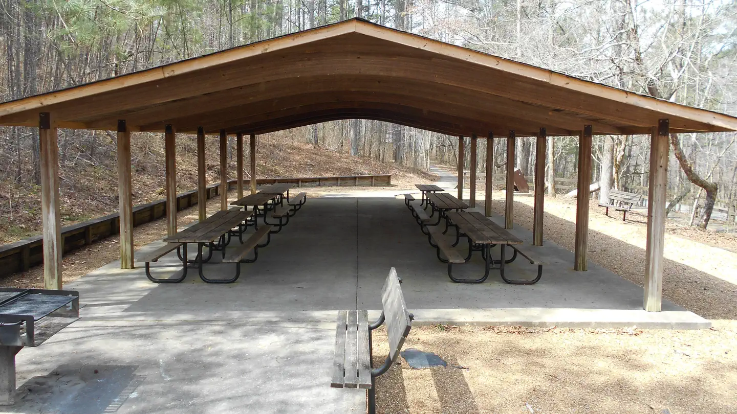
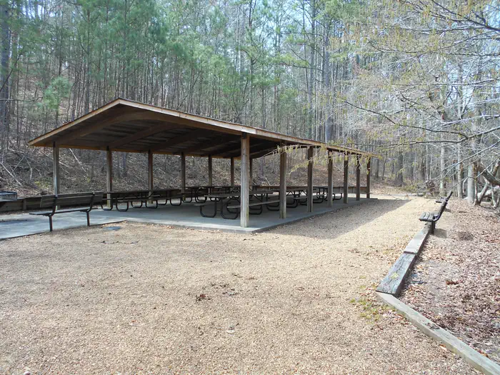
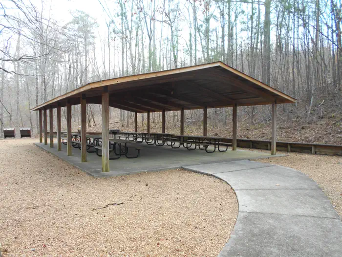
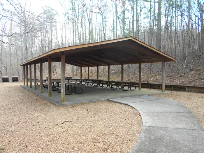
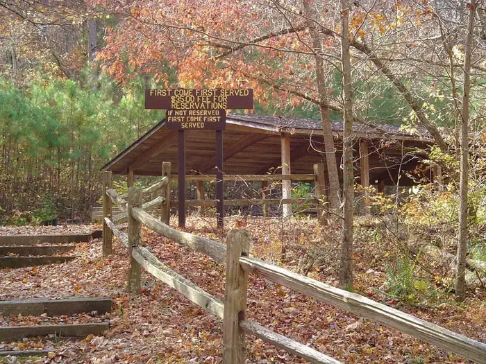
Pocket Picnic Shelter is a reservable shelter in the Pocket Recreation Area located in Armuchee, Ga. The shelter is a great location to hold family get togethers, birthday parties, work luncheons, retirement parties, or any other celebration one can think of.
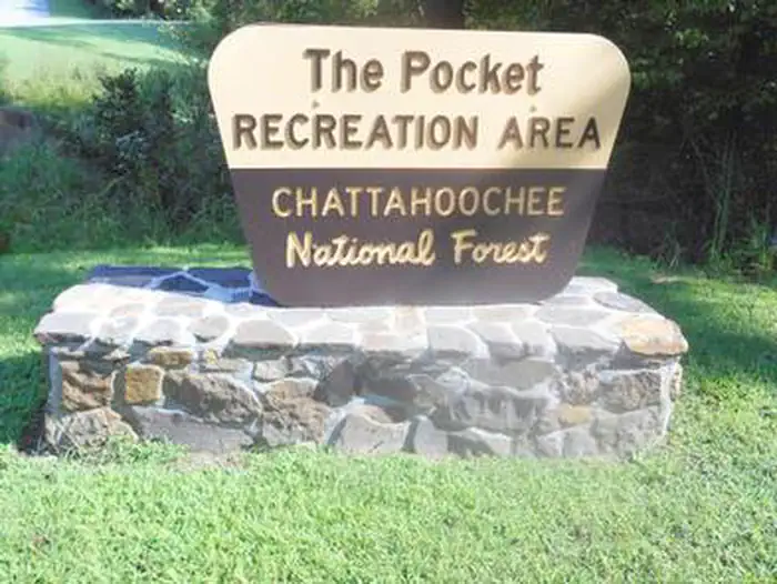
The Pocket Recreation Area is located within the Chattahoochee-Oconee National Forest in the ridges and valleys of northwest Georgia. The shelter sits in a low lying geographical area between Horn and Mill mountains. This low lying area was formed by limestone dissolving, leaving the ridges above and valleys below. These ridges are rich in iron ore "pockets" giving this area its name. Deer and turkeys thrive in the surrounding forest. Spring wildflowers and autumn colors abound, showcasing the beauty of the region. Nearby trails and overlooks allow visitors to enjoy the National Forest from different perspectives.
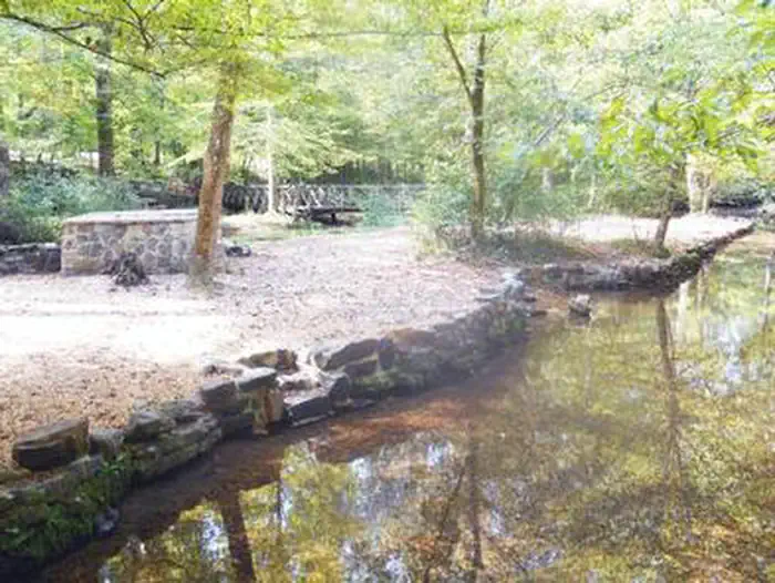
The Pocket area is rich in cultural and historical history. In the mid-1800s until the Great Depression in the 1930s, this area consisted of two communities, Pocket and Zone. These communities consisted of farms, churches, home places, a grist mill, a saw mill, and a general store. Between 1938 and 1942, the Pocket Recreation Area was the site of a thriving Civilian Conservation Corps (CCC) work camp for Company 3435. The men of the CCC, under the guidance of the U.S. Forest Service, had a tremendous impact on the area. They were involved in building roads, bridges, erosion control, tree planting, and the construction of recreation sites. The CCC played an instrumental part in helping local farmers with erosion control and road maintenance. Remnants of the camp can be found throughout the Pocket Recreation Area. These remnants include foundations for buildings, drainange trenches, and the retaining walls and spring box in the picnic area.
Activities in the Pocket Recreation Area include camping, picnicking, hiking, and trout fishing in nearby Johns Creek.
Recreation
The Pocket Picnic Shelter is located in the Pocket Picnic Area, part of the Pocket Recreation Area. The Pocket Recreation Area consists of the picnic shelter, a picnic area, and a campground. Camping, picnicking, hiking, birding, and wildflower viewing are all popular activities in the area.
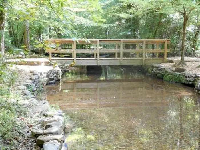
The trail heads for the Pocket Loop Trail and Pocket Interpretive Trail are located in the picnic area. A Civilian Conservation Corps spring box is located in the creek, releasing cold water from deep below the surface. This is a great place to wade and cool off during long summer days.
Hiking the 1.5 mile Pocket Interpretive Trail contains signs to provide an educational walk through multiple types of habitat where an array of wildlife and plant species can be found. The 2.5 mile Pocket Loop Trail provides a similar, but longer experience, sharing some of the same tread with the interpretive trail.
Visitors also enjoy the 3.5-mile Pocket Foot Trail that loops between the picnic area and a nearby campground. Interpretive signs are placed along the route, including a brief description of the area. It is a relatively wide path and a nice, easy walk.
Trout fishing in Johns Creek (less than a mile away) is a great place to wet a line and fill one's creel. Georgia DNR fishing regulations apply.
The Pocket Campground is adjacent to the picnic area. Information on the Pocket Campground can be found here: Pocket Campground
More information about the Chattahoochee-Oconee National Forest and other recreational activities can be found here: Chattahoochee-Oconee National Forest
Facilities
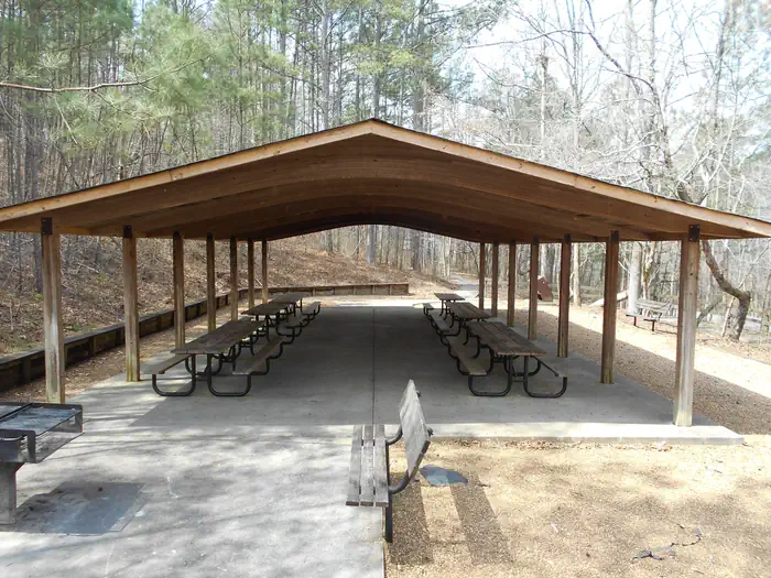
The accessible picnic shelter is available for group use with a reservation. If the area is not reserved, it is available on a first-come, first-served basis. The facility can accommodate up to 75 people and 20 vehicles.
The site is equipped with tables and grills. Accessible vault toilets are also provided. Drinking water is available across the parking area in the campground.
Natural Features
The Pocket Picnic Shelter is located off the Ridge and Valley Scenic Byway in northwest, Ga.
Surrounded by the horseshoe ridges formed by Horn and Mill Mountains, the Pocket is located in a geographical region known as the Ridge and Valley Province of Northwest Georgia, part of the Southern Appalachian Mountains. This region consists of long narrow ridges, sweeping valleys, creeks, streams, ponds, and waterfalls.
A small creek, locally known as Spring Branch (a tributary to nearby Johns Creek) meanders through the recreation area, providing a cool relief in the summer months. An informational interpretive loop trail and the Pocket Loop Trail leads visitors through a mixed pine/oak forest, past a small wildlife pond, and near wildlife food plots. This variety of natural features provides habitat for deer, turkeys, a multitude of song birds, and aquatic life, such as amphibians and beavers.
The Johns Mountain Overlook and the Keown Falls Picnic Area are found nearby. These two beautiful recreation sites showcase the natural features of the surrounding region.
Nearby Attractions
Johns Creek Trout Fishing Area: A great place to go trout fishing managed by the U.S. Forest Service and GA DNR with the help of Trout Unlimited.
Leaving the campground, turn left onto Pocket Road. After 1/4 mile stay right at the Y. After 1 mile look for legal pull-offs for fishing access. (Georgia DNR fishing regulations apply).
Johns Mountain Overlook: A U.S. Forest Service overlook where visitors can view the Armuchee Valley and distant Taylor's Ridge.
Leaving the campground, turn right onto Pocket Road. After 3 miles turn left at the Johns Mountain Overlook entrance sign (Forest Service Road 208). Follow FSR 208 for 2 miles to the overlook.
Keown Falls Picnic Area and Trailhead: A beautiful place to picnic with a loop hike to Keown Falls. Best seen after rain.
Leaving the campground, turn right onto Pocket Road. After 2 miles turn left at the Keown Falls Trailhead entrance sign (Forest Service Road 702). Follow FSR 702 for half a mile. The Keown Falls trail is a 3 mile loop trail. The falls are about 1 miles when following the trail counter clockwise.
Chestnut Mountain Shooting Range (Fee Area, see Recreation.gov page Chestnut Mountain Shooting Range ): A U.S. Forest Service shooting range to hone your shooting skills. You must provide your own firearm, ammunition, and targets.
Leaving the campground, turn right onto Pocket Road. After 4.6 miles turn right onto Furnace Creek Road. After 2 miles on Furnace Creek Road, turn right onto GA-136. Follow GA-136 for 5.7 miles. Turn left at the Chestnut Mountain Shooting Range entrance sign (Forest Service Road 212). Follow FSR 212 for a half mile.
Houston Valley OHV Area (Fee Area, see Recreation.gov page Houston Valley OHV Area ): A U.S. Forest Service ATV trail system. This is a designated area with 25 miles of various levels of trails where visitors can legally ride dirt bikes and ATVs (under 50 inches). On the Chattahoochee-Oconee National Forest ATVs and dirt bikes are limited to designated OHV trails and not allowed to be driven on roads designated as Forest Service Roads (National Forest Roads ARE NOT part of the county road system). Visitors must provide their own vehicles at this facility.
Leaving the campground, turn right onto Pocket Road. Follow Pocket Road for 7.3 miles then turn left onto GA-136. After 1/10th of a mile turn right onto GA-201. Follow GA-201 for approximately 5.5 miles and veer left onto Old Ringgold Road. After approximately 5 miles turn left onto Houston Valley Road. After 2 miles turn onto Capehart Road. Follow Capehart Road into the Houston Valley OHV parking lot.
The closest town is Dalton, Georgia, which is about 25 miles east of the picnic area. Dalton has numerous grocery stores, restaurants and gas stations available.
Getting there
From I-75, take Exit 320 (LaFayette/Resaca) and head west on Georgia State Route 136 for approximately 14 miles. Turn left onto Pocket Road and continue approximately 7 miles. The recreation area is on the left. The second driveway leads to the picnic shelter.
View on Recreation.gov ↗ Get directions ↗
Photo gallery
FAQ
How do I get a reservation at Pocket Picnic Shelter?
Reservations for Pocket Picnic Shelter are made through Recreation.gov. The current snapshot shows substantial availability: 179 of 183 tracked reservation dates are open (97.8%), though availability can change. Pick the shelter on the map to see its reservation calendar, or set a free Campsite Sniper alert. You complete the reservation yourself on Recreation.gov.
Does Campsite Sniper book this facility for me?
No. Campsite Sniper sends alerts and direct Recreation.gov links. It never books, pays for, holds, hoards, or resells reservations.
How current is this availability data?
Campsite Sniper re-checks public Recreation.gov availability for this facility every hour and republishes whenever anything changes. This facility's data last changed at Sep 18, 2026 15:19 UTC; an older timestamp means nothing has changed since that time, not that checking stopped. Always confirm final availability on Recreation.gov when you book.
Which month has the most availability at Pocket Picnic Shelter?
December 2026, with 31 open reservation dates in the current snapshot of 31.
When is the next open date at Pocket Picnic Shelter?
As of the Sep 18, 2026 snapshot: the next open date is Mon, Sep 21 and the next open weekend starts Fri, Sep 25. Detected openings can add earlier dates at any time; a free Campsite Sniper alert catches those the moment they appear.
Let the app watch this shelter
Choose the reservation dates you want at Pocket Picnic Shelter.
Campsite Sniper can monitor this facility and notify you if a selected date becomes available.
When a selected date becomes available, you get a push with a Recreation.gov link so you can review and book it yourself.