Availability is not tracked here yet
The site details and map below come from the public Recreation.gov record and are accurate. For current dates and to book, go to Recreation.gov.
About Tanners Flat
Overview
Tanners Flat Campground is located in scenic Little Cottonwood Canyon at an elevation of 7,200 feet, just 6 miles from Sandy, Utah. The canyon offers many hiking and biking opportunities.
Recreation
Hiking and mountain biking trailheads can be found throughout the canyon. Hikers enjoy Red Pine Lake, White Pine Lake and Maybird Gulch, all beautiful hikes leading to alpine lakes. Mountain bikers enjoy the Cottonwood Creek Trail and Albion Meadows Trail.
Little Cottonwood Creek offers good trout fishing and is a favorite among local fly-fishermen.
Facilities
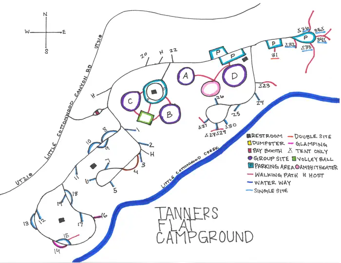
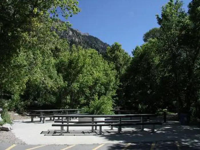
The campground contains 31 single sites, three double sites, four overnight group sites and an amphitheater. The family and overnight group sites have picnic tables and campfire rings. The group overnight sites also have grills and serving tables. The amphitheater has benches and a presentation area, but does not have tables or a fire ring. The amphitheater is available in four hour blocks (8am-12pm, 1pm-5pm, 6pm-10pm).
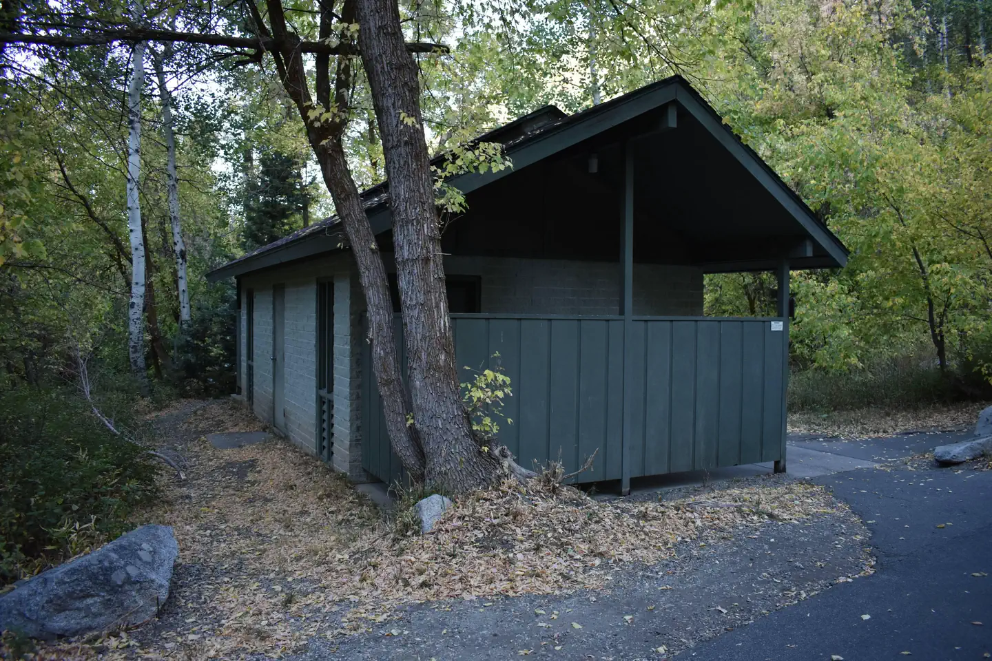
Flush and vault toilets are provided, as is drinking water. A volleyball court is available but campers must bring their own net and ball. Firewood is available for purchase from the host. Roads and parking spurs are paved.
Natural Features
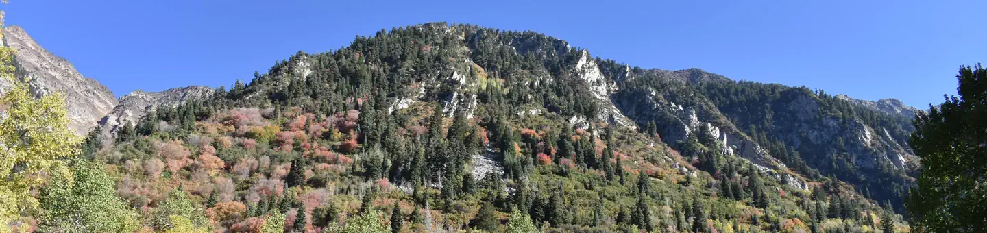
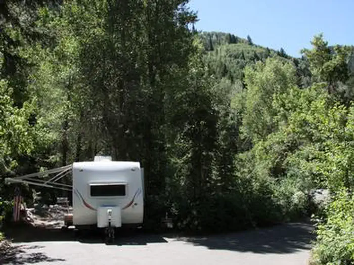
The campground is set among a forest of shady pine, aspen, oak and maple trees. Vivid summer wildflowers are abundant, and autumn leaves put on quite a show. Little Cottonwood Creek runs along the edge of the campground.
Nearby Attractions
Little Cottonwood Canyon is a beautiful area known for its soaring peaks, unique geology, pristine hidden lakes and cascading streams. Numerous hiking and mountain biking trails are in the area. Rock climbing is a popular activity as well.
Snowbird Resort is a few miles up-canyon, offering scenic tram rides, hiking, mountain biking, restaurants, groceries, an Alpine Slide, zip line rides, concerts and various festivals.
Albion Basin, part of Alta Ski Resort just a few miles further up-canyon, hosts the Wasatch Wildflower Festival annually in late July/early August, complete with guided nature walks. Numerous hiking trails can be found in Albion Basin, including the 1.5-mile round-trip hike to Cecret Lake.
Getting there
From I-215, take the 6200 South exit and travel a mile east to Wasatch Blvd. Take Wasatch Blvd 3 miles south to junction with Little Cottonwood Canyon/Highway 210. Take a left at the junction and travel up Little Cottonwood Canyon for 4.1 miles to the campground.
View on Recreation.gov ↗ Get directions ↗
Photo gallery





FAQ
How do I get a reservation at Tanners Flat?
Online reservations for this facility, where offered, are made through Recreation.gov. Pick a site or unit on the map to see its calendar, or set a free Campsite Sniper alert. You complete the reservation yourself on Recreation.gov.
Does Campsite Sniper book this facility for me?
No. Campsite Sniper sends alerts and direct Recreation.gov links. It never books, pays for, holds, hoards, or resells reservations.
How current is this availability data?
Campsite Sniper does not currently hold availability data for Tanners Flat, so there is nothing to date here. That is a gap in coverage — it does not mean the facility is full or closed. Check Recreation.gov for current dates.
Which sites at Tanners Flat fit a 35-foot RV?
No RV-analyzable site here has a recorded maximum of 35 ft or more; the longest recorded is 33 ft. 5 of those 19 sites have a recorded maximum length and 14 do not; they are not counted as fitting.
Stop refreshing. Let the app watch it.
Lakefront, hookups, your RV length, weekends only - set it as picky as you want.
We run paced availability checks for Tanners Flat. One watch covers every matching site.
When a match opens, you get a push with a Recreation.gov link so you can review and book it yourself.