Openings · last 7 days
1
Pick a site on the map to see its availability calendar.
Only 5 openings in the last 90 days: not enough recent activity for a reliable pattern. A free Campsite Sniper alert watches around the clock instead, and pings you the moment one opens.
Of the 3,843 tracked site-nights (Sep 18, 2026 – Mar 19, 2027): 1,587 open for online reservation · 66 reserved · 190 closed · 2,000 not yet released.
Of the open site-nights on mapped sites, 915 fall on weekdays and 672 on weekends (Fri–Sun).
January shows no online availability. 0 of 651 tracked site-nights are open there — 31 closed, 620 not yet released.
| Window | Night | Sites open | Status |
|---|---|---|---|
| Labor Day | SAT Sep 5 | 0 | None open |
| SUN Sep 6 | 0 | None open | |
| MON Sep 7 | 0 | None open | |
| Thanksgiving | THU Nov 26 | 20 | Open |
| FRI Nov 27 | 20 | Open | |
| SAT Nov 28 | 20 | Open | |
| Christmas | THU Dec 24 | 0 | None open |
| FRI Dec 25 | 0 | None open | |
| New Year | THU Dec 31 | 0 | None open |
| FRI Jan 1 | 0 | None open |
Labor Day: no online availability on any tracked night. Thanksgiving: 20 sites are available for the complete three-night stay. Christmas: no online availability on any tracked night. New Year: no online availability on any tracked night.
| Site | Open site-nights |
|---|---|
| Juniper Basin 2 | 83 |
| Juniper Basin 3 | 83 |
| Spud Rock 3 | 83 |
| Happy Valley 1 | 82 |
| Juniper Basin 1 | 82 |
The 5 sites with the most open site-nights in the current snapshot. Pair a bookable date with a free alert to cover everything else.
The next bookable night is Sep 18; the first open weekend starts Sep 18. Campsite Sniper can watch later dates for you.
Multi-night stays. 67 2-night, 63 3-night, 52 7-night openings where a single site is free for every night, per Campsite Sniper's current snapshot — soonest Sep 18 at site Juniper Basin 2.
| Site | Hookups | Open site-nights | Longest run | Dates |
|---|---|---|---|---|
| Juniper Basin 2 | None | 83 | 83 nights | Sep 18, Sep 19, Sep 20, Sep 21, Sep 22, Sep 23, Sep 24, Sep 25, Sep 26, Sep 27, Sep 28, Sep 29 +71 more |
| Juniper Basin 3 | None | 83 | 83 nights | Sep 18, Sep 19, Sep 20, Sep 21, Sep 22, Sep 23, Sep 24, Sep 25, Sep 26, Sep 27, Sep 28, Sep 29 +71 more |
| Spud Rock 3 | None | 83 | 83 nights | Sep 18, Sep 19, Sep 20, Sep 21, Sep 22, Sep 23, Sep 24, Sep 25, Sep 26, Sep 27, Sep 28, Sep 29 +71 more |
| Happy Valley 1 | None | 82 | 55 nights | Sep 18, Sep 19, Sep 20, Sep 21, Sep 22, Sep 23, Sep 24, Sep 25, Sep 26, Sep 27, Sep 28, Sep 29 +70 more |
| Juniper Basin 1 | None | 82 | 51 nights | Sep 18, Sep 19, Sep 20, Sep 21, Sep 22, Sep 23, Sep 24, Sep 25, Sep 26, Sep 27, Sep 28, Sep 29 +70 more |
| Spud Rock 1 | None | 82 | 68 nights | Sep 18, Sep 19, Sep 20, Sep 21, Sep 22, Sep 23, Sep 24, Sep 25, Sep 26, Sep 27, Sep 28, Sep 29 +70 more |
| Spud Rock 2 | None | 82 | 68 nights | Sep 18, Sep 19, Sep 20, Sep 21, Sep 22, Sep 23, Sep 24, Sep 25, Sep 26, Sep 27, Sep 28, Sep 29 +70 more |
| Manning Camp 4 | None | 81 | 49 nights | Sep 18, Sep 19, Sep 20, Sep 21, Sep 22, Sep 23, Sep 24, Sep 25, Sep 26, Sep 27, Sep 28, Sep 29 +69 more |
| Manning Camp 5 | None | 81 | 50 nights | Sep 18, Sep 19, Sep 20, Sep 21, Sep 22, Sep 23, Sep 24, Sep 25, Sep 26, Sep 27, Sep 28, Sep 29 +69 more |
| Douglas Springs 2 | None | 80 | 33 nights | Sep 18, Sep 19, Sep 20, Sep 21, Sep 22, Sep 23, Sep 24, Sep 25, Sep 26, Sep 27, Sep 28, Sep 29 +68 more |
| Happy Valley 3 | None | 80 | 34 nights | Sep 19, Sep 20, Sep 21, Sep 22, Sep 23, Sep 24, Sep 25, Sep 26, Sep 27, Sep 28, Sep 29, Sep 30 +68 more |
| Manning Camp 2 | None | 80 | 35 nights | Sep 18, Sep 19, Sep 20, Sep 21, Sep 22, Sep 23, Sep 24, Sep 25, Sep 26, Sep 27, Sep 28, Sep 29 +68 more |
| Happy Valley 2 | None | 79 | 72 nights | Sep 18, Sep 19, Sep 20, Sep 21, Sep 22, Sep 23, Sep 24, Sep 29, Sep 30, Oct 1, Oct 2, Oct 3 +67 more |
| Grass Shack 1 | None | 78 | 32 nights | Sep 18, Sep 19, Sep 20, Sep 21, Sep 22, Sep 23, Sep 25, Sep 26, Sep 27, Sep 28, Sep 29, Sep 30 +66 more |
| Grass Shack 3 | None | 78 | 32 nights | Sep 18, Sep 19, Sep 20, Sep 21, Sep 22, Sep 23, Sep 24, Sep 25, Sep 26, Sep 29, Sep 30, Oct 1 +66 more |
| Douglas Springs 1 | None | 76 | 27 nights | Sep 18, Sep 19, Sep 20, Sep 21, Sep 22, Sep 23, Sep 24, Sep 25, Sep 26, Sep 30, Oct 1, Oct 2 +64 more |
| Manning Camp 3 | None | 76 | 29 nights | Sep 18, Sep 19, Sep 20, Sep 21, Sep 22, Sep 23, Sep 24, Sep 25, Sep 26, Sep 27, Sep 28, Sep 29 +64 more |
| Manning Camp 6 | None | 76 | 27 nights | Sep 18, Sep 20, Sep 21, Sep 22, Sep 23, Sep 24, Sep 25, Sep 26, Sep 27, Sep 28, Sep 29, Sep 30 +64 more |
| Douglas Springs 3 | None | 75 | 28 nights | Sep 18, Sep 19, Sep 20, Sep 21, Sep 22, Sep 23, Sep 24, Sep 25, Sep 26, Sep 27, Sep 28, Sep 29 +63 more |
| Manning Camp 1 | None | 70 | 17 nights | Sep 18, Sep 19, Sep 20, Sep 21, Sep 22, Sep 24, Sep 25, Sep 26, Sep 27, Sep 28, Sep 29, Sep 30 +58 more |
Wilderness campgrounds are the ONLY campgrounds in Saguaro National Park. For fit hikers interested in backpacking a minimum of 4.4 miles (7 km) into the rugged Rincon Mountains, six wilderness campgrounds are available.
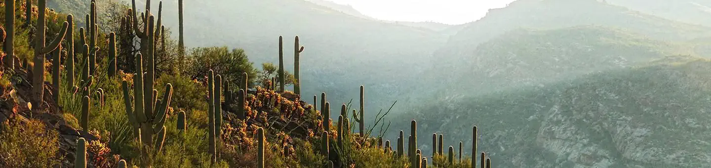
The Rincon Mountains in Saguaro National Park rise out of the Sonoran Desert to over 8000 feet (2438 m) in elevation and host vegetative communities ranging from desert cacti, desert grasslands, and oak woodlands, to mixed conifer forests. In 1976, congress designated 57,930 acres (23,443 ha) within these Mountains as the Saguaro Wilderness managed as "an area where the each and its community of life are untrammeled by humans, where people themselves are visitors who do not remain."
None of these wilderness campgrounds is accessible by vehicle (including RVs) . For car or RV camping, the only options in the immediate area are private or commercial campgrounds. Further away, there are campgrounds in the Coronado National Forest, some of which may be available to book on Recreation.gov.
Solitude awaits you on these cool, forested slopes. A strenuous hike and the solitude of the wilderness are the primary forms of recreation in the Rincon Mountains. From cactus-covered desert to pine-cloaked mountain heights, the Saguaro Wilderness Area in the Rincon Mountains protects the last roadless ‘sky island’ mountain range in Southern Arizona. All within sight of the sprawling city of Tucson. Limited overnight livestock pack trips are permitted in the park. Please contact 520-733-5153 for additional information.
Plant and wildlife viewing is also popular...a hike to any of the six wilderness campgrounds in the Rincon Mountains provides a stark chronical of plant and animal life as you climb from saguaro cactus forests at your trailhead to grasslands, manzanita and scattered juniper at Douglas Spring (minimum 6 miles/9.6 km and a 2000 foot/609 m climb) to a full stand of juniper trees at Juniper Basin (6,000 feet/(1829 m). By the time you reach Manning Camp at 8000 feet (2438km) you’re in a ponderosa pine forest with reliable water year-round except in the very driest years.
Water
Without question, water will be your most important concern while visiting the Saguaro Wilderness. Surface water is generally scarce during most of the year. At times, it is non-existent. Start your trip with plenty of potable water. Know where water sources are located and plan your trip according to water availability.
It is recommended that you treat/filter all water used for human consumption.
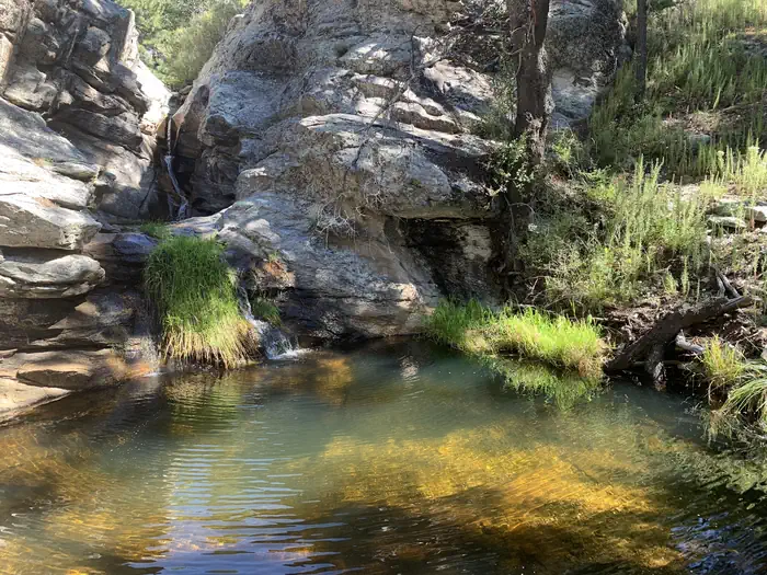
All campgrounds within the Saguaro Wilderness are situated next to intermittent streams or springs. During dry seasons, water may not be available. The water source at Manning Camp is a spring surrounded by chain link fencing. Please do not enter the fenced area. Water may be obtained a short distance downstream. The water tap at the Manning Camp Cabin is not for public use and is usually turned off.
If your itinerary calls for you to exit on the same trail you entered, you might consider caching potable water along the trail. This will assure a source of drinking water on your way out. We recommend sealed water containers with your name and the date written on them.
For current water reports, inquire at the visitor center - (520) 733-5153.
Weather
Temperatures and weather can vary greatly across the Saguaro Wilderness and is largely dependent on elevation.
Manning Camp is located at an elevation of 8,000 feet (2438 m), and the visitor center is at an elevation of 3,080 feet (939 m).
The average high temperature at the visitor center in January is 63° F (17° C) and the average low temperature is 38° F (3° C). For the same month, the average high temperature at Manning Camp is 44° F (7° C) and the average low is 25° F (-4° C).
In June, the average high temperature at Manning Camp is 77° F (25° C) and the average low temperature is 48° F (9° C). For the same month, the average high temperature at the visitor center is 98° F (37° C) and the average low temperature is 67° F (19° C).
Winter Rainy Season : The typical winter rainy season occurs from December through February. Rainfall is generally light and gentle but may fall for extended periods. Expect snow at higher elevations. Summer Rainy Season : The typical summer rainy season occurs from July through September. Rainfall can be intense and heavy. Lightning and flash flooding are common - extra caution is advised.
When to Go
Summer temperatures in the Sonoran Desert regularly exceed 100° F (38° C) and can reach 115° F (46° C). Higher elevation areas such as Manning Camp can receive significant winter snowfall.
Spring and Fall can be ideal times to backpack in the Saguaro Wilderness but it is still important to pay attention to projected weather. If the predicted high temperature at your trailhead is between 80° and 95° F, plan your trip so that you arrive at higher elevations by early afternoon. If the predicted high temperature is between 95° and 110° F, leave the trailhead early enough that you can arrive at elevations over 7000 feet (2133 m) by 10 a.m. -- leaving the trailhead before sunrise is recommended. And, if the predicted high temperature is over 110° F, consider cancelling your trip.
At any time of the year, backpackers should plan to leave their trailhead by noon. Backpacking in the Rincon Mountains is a difficult endeavor. Later starts frequently lead to camping illegally in areas other than designated campgrounds.
Livestock. Limited overnight livestock pack trips are permitted in the park. Please contact 520-733-5153 for additional information.
Topographic Maps
All visitors to the Saguaro Wilderness should have the necessary orienteering and map reading skills to safely get around. We suggest that you carry National Geographic’s “Trails Illustrated Map”, which covers the entire park in one waterproof, tear-resistant map. The map is available at the visitor center.
If you would like to purchase the map to aid in planning trip, by mail or phone prior to your arrival contact the Western National Parks Association bookstore.
WNPA Bookstore
3693 South Old Spanish Trail
Tucson, Arizona 85730
(520) 733-5155
This is not car or RV camping! It is not possible to drive to the campgrounds.The 6 campgrounds are primitive and offer few, if any, amenities. Campgrounds require a minimum hike of 4.4 miles (7 km) to the closest (lowest elevation) campground, while Manning Camp is a minimum hike of 10 miles (22.5 km) depending on your starting trailhead.
Water: While all campgrounds are near intermittent streams or springs, during dry seasons, water may not always be available. Start your trip with at least one gallon (4 L) of water per person per day. Treat all water for human consumption.
Campfires . While some campgrounds have fire rings and grills, fires are prohibited at others. Gas stoves are encouraged at all campgrounds.
Toilets. Toilets at campgrounds are rarely visited by park staff. Campers are strongly encouraged to carry and use personal hand sanitizer.
Primitive Campground Amenities:
Douglas Spring (4,800 feet/1463 m): 3 campsites, No Campfires! There are plenty of mesquites and junipers in the area that provide some shade in the hotter months. Water is seasonal. The campground has a vault toilet.
Grass Shack (5,200 feet/1585m): 2 campsites under the shade of large oaks and other trees. No Campfires! Chimenea Creek provides water most of the year. The campground has a vault toilet.
Juniper Basin (6,000 feet/1829 m): 3 campsites. Water is seasonal (often dry during the spring and fall). The campground has a vault toilet. Fires are allowed here using only dead and downed wood.
Happy Valley Saddle (6,200 feet/1890 m): 3 campsites. Water is available only during wet times. The campground has a vault toilet.
Spud Rock Spring (7,400 feet/2255 m): 3 campsites under the shade of pines and aspens. Water is available seasonally. The campground has a composting (pit) toilet.
Manning Camp (7,920 feet/2414 m): 6 campsites, each with a fire ring and grill, shaded by ponderosa pines. Water is virtually always available. The campground has a vault toilet.
The 70,000 square mile (18,1299 sq. km) Sky Island region of southeastern Arizona, southwestern New Mexico, and northwestern Mexico is globally important because of its rich diversity of species and habitats. These mountain "islands"--which include the Rincon Mountains—are --forested ranges separated by vast expanses of desert and grassland plans and , are among the most diverse ecosystems in the world. The Rincon Mountains of Saguaro National Park are the largest roadless sky island in the region.
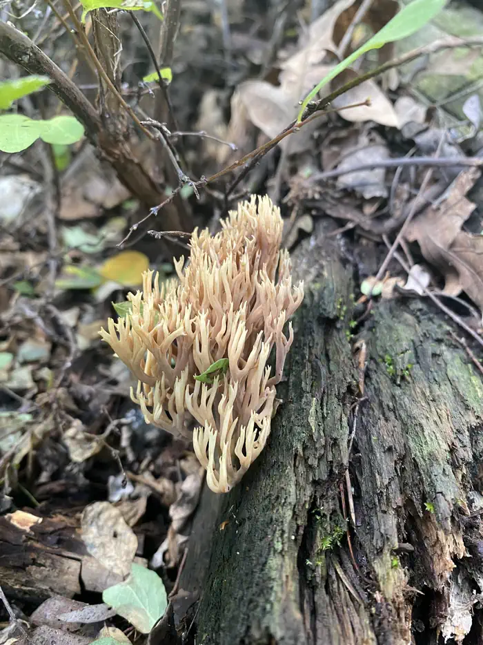
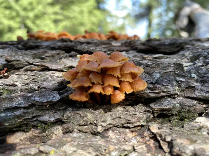
Are you constantly checking out cool flowers, bugs, and mushrooms along the trail? Saguaro National Park biologists would love to know what you're seeing! The park is revamping a project to document rare plants in the remote Rincon Mountain backcountry. If you make a free iNaturalist account (at inaturalist.org or the iNaturalist app), you can submit photo observations of plants and other living things you notice while hiking. Our staff and other specialists will help with IDs! For more information, check out our iNaturalist project Plants of the Saguaro NP High Country. Join the project if you’d like occasional updates on target species, seasonal trends, and exciting findings. Visitor-submitted observations help us learn more about mountain plant communities including distributions, flowering times, and leaf emergence. Rare sightings are always a possibility too! This project complements focused survey efforts conducted by botanists, park staff, and trained volunteers.
This is not car or RV camping! There are no campgrounds accessible by vehicle (including RVs) within Saguaro National Park. For fit hikers interested in backpacking a minimum of 4.4 miles into the rugged Rincon Mountains, 6 wilderness campgrounds are available. The six campgrounds within the Saguaro Wilderness are accessed only by hiking a minimum of 4.4 miles (7 km). Trailhead Driving Directions Five trailheads lead into the Saguaro Wilderness. To help you plan your trip, we have separated these trailheads by the level of difficulty it takes to reach a particular trailhead. Access to the Saguaro Wilderness is available from the south boundary of the park, at Camino Loma Alta Trailhead. There is NO public access to Madrona, which is permanently closed and is not staffed at any time. Access to the Saguaro Wilderness via the Miller Creek, Turkey Creek and Italian Spring Trailheads is through US Forest Service (USFS) lands (driving directions below). For more details, visit the Coronado National Forest Hiking web page. Trailhead Elevation Douglas Spring 2,750 feet (838 m) Tanque Verde Ridge 3,100 feet (945 m) Miller Creek 4,200 feet (1280 m) Turkey Creek 4,250 feet (2343 m) Italian Spring 4,800 feet (1463 m) Easy Access The Tanque Verde Ridge Trailhead is located of the park’s scenic loop drive, within the Javelina Picnic Area. Vehicle access to the Tanque Verde Ridge Trailhead is available from 7:00 a.m. to sunset daily. The scenic loop drive is closed and locked nightly from 8:30 p.m until 5:00 a.m. Note: Summer hikers should choose a different route. You cannot access this trailhead early enough (before sunrise) to avoid extreme summer temperatures. The Douglas Spring Trailhead is located at the east end of Speedway Boulevard and is accessible 24 hours per day. Due to this easy access, vehicle break-ins have occurred at this trailhead. Do not leave valuables inside your vehicle - visible or otherwise. Many wilderness users choose to have a friend drop them off and pick them up rather than leaving a vehicle at this trailhead. Moderate Access Both the Miller Creek and Turkey Creek Trailheads are located on USFS lands and are generally accessible by light truck or car. However, during or after heavy rainfall, access to these trailheads can be restricted or impassable. You must hike an additional 1.5 miles/2.4 km (on either trail to reach the boundary of Saguaro National Park. To reach either of these trailheads ,take Interstate 10 to exit #297 and head north. The road is paved for the first two miles (3.2 km) and graded gravel for the remainder of its length. When you enter the Coronado National Forest, the road is named USFS Route #35. The turnoff to the Miller Creek Trailhead is 16 miles (26 km) north of I-10. The Turkey Creek Trailhead turnoff is one half mile beyond the Miller Creek turnoff. Look for USFS Route #4408 and turn left. Vehicles without high clearance and 4-wheel-drive will not be able to negotiate the last 1.6 miles (2.5 km) of road leading to the Turkey Creek Trailhead. The Loma Alta Trailhead is at the north end of Camino Loma Alta, north of Old Spanish Trail. Horse parking is at pavement end; hikers may proceed one half mile further on a dirt road. Difficult Access The Italian Spring Trailhead is the most difficult trailhead to access. To reach this trailhead, drive east on Tanque Verde Road. At the intersection with Wentworth Road, Tanque Verde Road will change names to Redington Road. At the boundary of the Coronado National Forest, the surface of Redington Road will change from pavement to gravel. While the gravel portion of Redington Road does not require 4-wheel-drive, high clearance is recommended as it is not regularly maintained and is usually in poor condition. From the beginning of the gravel, travel 9.6 miles (15.4 km) to USFS Route #37 and turn right. Vehicles with 4-wheel-drive and high clearance may drive an additional 2.6 miles (4 km) to the Italian Spring Trailhead. This trailhead is located on USFS lands; you must hike an additional 5.1 miles (8 km) to reach the boundary of Saguaro National Park.
View on Recreation.gov ↗ Get directions ↗




Reservations for Saguaro National Park Wilderness Permits are made through Recreation.gov. 1,587 of 3,843 tracked site-nights are currently open (41.3%). Campsite Sniper has also detected 5 site openings here in the last 90 days, so further dates may appear. Pick a site on the map to see its calendar, or set a free Campsite Sniper alert. You complete the reservation yourself on Recreation.gov.
No. Campsite Sniper sends alerts and direct Recreation.gov links. It never books, pays for, holds, hoards, or resells reservations.
Campsite Sniper re-checks public Recreation.gov availability for this facility every hour and republishes whenever anything changes. This facility's data last changed at Sep 18, 2026 13:18 UTC; an older timestamp means nothing has changed since that time, not that checking stopped. Always confirm final availability on Recreation.gov when you book.
Campsite Sniper detected 1 site-date opening at Saguaro National Park Wilderness Permits in the last 7 days, 5 over 30 days and 5 over the last 90.
63 three-night openings are showing, counting only runs where the SAME site is free for all three nights. The soonest starts Sep 18 at site Juniper Basin 2. Confirm and book on Recreation.gov.
October 2026, with 587 open site-nights in the current snapshot of 651.
As of the Sep 18, 2026 snapshot: the next open date is Fri, Sep 18 and the next open weekend starts Fri, Sep 18. Detected openings can add earlier dates at any time; a free Campsite Sniper alert catches those the moment they appear.
Lakefront, hookups, weekends only - set it as picky as you want.
We run paced availability checks for Saguaro National Park Wilderness Permits. One watch covers every matching site.
When a match opens, you get a push with a Recreation.gov link so you can review and book it yourself.